
2024
A pdf version of the seventh edition of Geospatial Analysis is available at www.spatialanalysisonline.com.
2021
Handbook of Regional Science, Second and Extended Edition. Manfred M Fischer and Peter Nijkamp, editors, Springer Reference. Contains chapter on Geographic Information Science (GIScience) by Michael F. Goodchild and Paul A Longley.
2018
Consumer Data Research (PA Longley, J Cheshire and A Singleton). London, UCL Press.
Big Data collected by customer-facing organisations – such as smartphone logs, store loyalty card transactions, smart travel tickets, social media posts, or smart energy meter readings – account for most of the data collected about citizens today. As a result, they are transforming the practice of social science. Consumer Big Data are distinct from conventional social science data not only in their volume, variety and velocity, but also in terms of their provenance and fitness for ever more research purposes. The contributors to this book, all from the Consumer Data Research Centre, provide a first consolidated statement of the enormous potential of consumer data research in the academic, commercial and government sectors – and a timely appraisal of the ways in which consumer data challenge scientific orthodoxies.
A free PDF of the book can be obtained here.
There is also an extended chapter on Big Data and Geospatial Analysis, including links to new resources at:
www.spatialanalysisonline.com.
Geospatial Analysis: A Comprehensive Guide (2018)
A 6th edition has been published of the open access, free web resource and online ebook by Mike de Smith (UCL Geography PhD), Mike Goodchild (UC Santa Barbara), Paul Longley (UCL Geography), with colleagues. printed version via Amazon’s Kindle Direct Publishing service. Completely updated, it offers a comprehensive guide to concepts, methods and tools, interactive links, and many practical examples using popular software such as ArcGIS, Idrisi, Grass, Surfer and others.
A companion Statistical Analysis Handbook, authored by Mike de Smith, has also been updated as a website resource for statistical techniques in the earth, social, medical and other SMT disciplines. A version of this material is available for offline usage by course tutors, with a PDF extract available via the website or directly via this link.
2015
Geographic Information Science and Systems, Fourth Edition (P A Longley, M F Goodchild, D J Maguire and D W Rhind). The book has also been published in Chinese, Korean, Polish, Czech and Portuguese.
The book sets out a research-led multi-disciplinary treatment of the scientific principles that underpin the use of geographic information technologies for problem-solving. It also provides a comprehensive guide to the enduring scientific principles that underpin effective use of today’s powerful GI technologies. It also provides a primer on essential methods for analysis of GI, and the ways in which effective management of GI informs policy and action.
2014
Spatial Analysis and Geocomputation, Section 7 of Handbook of Regional Science (M M Fischer, P Nijkamp, eds). Berlin, Springer (Section 7, pp1104-1273, Editor P A Longley)
2013
Geoinformatics for City Transformations. Proceedings, GIS Ostrava 2013, Tenth International Symposium (I Ivan, P A Longley, J Horak, Fritsch, J Cheshire, T Inspektor, eds.)
2012
Environment and Planning Volume B: Planning and Design. (M Batty and P A Longley)
Environment and Planning Volume E: Foundations (S Elden, N Thrift, T J Barnes, J Peck, M Batty, P A Longley, R J Bennett)
2011
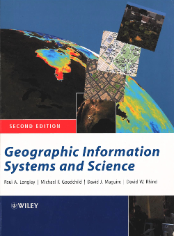
Geographic Information Systems and Science (Third Edition) (P A Longley, M F Goodchild, D J Maguire, D W Rhind) The Third Edition of this widely-used textbook has been fully revised and updated to include the latest developments in the field, and still retains its accessible format to appeal to a broad range of students. Now divided into five sections, the book investigates the unique, complex and difficult problems that are posed by geographic information and together they build into a holistic understanding of the key principles of GIS.
2009
Geospatial Analysis: a Comprehensive Guide to Principles, Techniques and Software Tools. (M J de Smith, M F Goodchild, P A Longley). The three editions of this book (published in 2007, 2008 and 2009 by Troubador, Leicester, UK) are hard copy versions of an extensive and detailed technical website, www.spatialanalysisonline.com. The “Geospatial Analysis” project addresses the full spectrum of analytical techniques that are provided within modern Geographic Information Systems (GIS) and related geospatial software products. It is broad in its treatment of concepts and methods and representative in terms of the software that people actually use.
2005
Geographical Information Systems: Principles, Techniques, Management and Applications, Abridged Edition. (P A Longley, M F Goodchild, D J Maguire, D W Rhind). For many years, the definitive work on the science, application and practice of GIS. The updated and abridged Second Edition of Geographical Information Systems brought the definitive reference (first published in 1999) to a whole new audience in a streamlined format. The entire work is available in a Chinese edition.
Geographic Information Systems and Science, second edition). (P A Longley, M F Goodchild, D J Maguire, D W Rhind). The second edition of the pre-eminent textbook in its field communicates the richness and diversity of GIS in a lucid and accessible format. This fully revised and updated second edition reinforced the view of GIS as a gateway to science and problem solving, set out the scientific principles that govern its use, and described the impact of people on its development, design, and success. The book was translated into Chinese and Polish.
2003
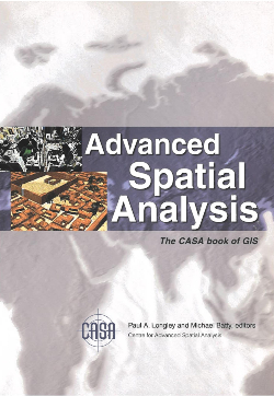
Advanced Spatial Analysis (P A Longley, M.Batty). A gallery of advanced work on GIS applications in such fields as archaeology, architecture, cartography, computer science, environmental science, geography, planning, remote sensing, geomatic engineering, and transport studies, and carried out in UCL’s Centre for Advanced Spatial Analysis.
2001
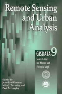
Remote Sensing and Urban Analysis. (J-P Donnay, M J Barnsley, P A Longley, eds). A wide range of methodologies for the production and analysis of urban remote sensing data are outlined in this book. Surface models are considered for the analysis of integrated data sets, in which the scope of the applications is widened to consider the estimation of human population levels.
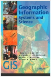
Geographic Information Systems and Science (P Longley, M F Goodchild, D J Maguire, D W Rhind). This advanced textbook and professional guide book became the fastest selling title in the history of the subject, selling more than 25,000 copies in this first edition. Innovative features included its treatment of the Internet as being at the heart of GIS applications.
1996
Spatial Analysis: Modelling in a GIS Environment (P A Longley, M Batty, eds). This book addresses spatial analysis with an emphasis on the integration of different spatial analysis functions within GIS. It focuses on developing advanced GIS functions for problem solving, prediction and forecasting. All of the models and applications in this book stress spatial systems of particular relevance to human geographers and spatial policy analysts, with emphasis upon spatial analysis applications and practical problem solving.
1995
GIS for Business and Service Planning (P A Longley, G P Clarke, eds). This volume is the first systematic attempt to examine the practical use of GIS for business and service planning. It considers ways in which GIS may be customised to meet specific user requirements and tackle a range of important applied research challenges.
1994
Fractal Cities: a Geometry of Form and Function (M Batty, P A Longley). This major book presents an approach to measuring and simulating the form and function of towns and cities, using ideas from fractal geometry, urban modelling and computer graphics. Available as a free download: http://www.fractalcities.org/
.